Tuesday, May 18, 2010

We're There

Bachelor Point Marina in Oxford, MD
Oxford, MD - We left Beaufort, NC on May 11 and had rough seas rounding Cape Lookout. We motored into them with both sails. About six hours later, the sea calmed and we motored all evening, rounding Cape Hateras about 10 p.m. About 4 a.m., the wind came up and we sailed all morning, including a stretch of 20k wind where the boat speed reached 8k.

Squall off Chesapeake Bay Bridge/Tunnel

Captain Squall
We motored as we neared the ship channel for the Chesapeake Bay entrance, passing military boats along the way. The weather report had severe thunderstorm warnings out for counties in North Carolina and Virginia, but we weren't sure where those counties were; however, as we neared the Chesapeake Bay Bridge Tunnel, the sky grew dark and lightening flashed. We took down the mainsail and hunkered down behind one of the tunnel abutments just in time for a downpour and lightening show. We watched the squall on the radar and were glad the anchor was holding. After the storm passed, a giant car carrier ship passing through the channel hailed us on the VHF to see if we were alright, which we were. Steve told me that he'd gotten the nickname captain squall in the Caribbean since they'd endured a squall four consecutive times he'd come on watch.
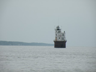
Old Chesapeake Lighthouse
Narrow Channels
So, we got back under way up the bay to Cape Charles. The Chesapeake Bay is relatively shallow and towns along its coasts have dredged channels out to deep water. By this time it was dark and we had to navigate flashing red, white, and green lights and ranges to enter the harbor. Once there (of course, we'd never been there), it was just a small place with a town on one side and an industrial complex 100 yards across the harbor. We parked right in the middle.

Layers
By this time, we'd stopped using fans to keep cool while sleeping at night and gotten out the blankets again. We had to wear several layers top and bottom to keep warm. What happened to summer?

Oxford
We had a smooth sail that morning up the bay until the wind died and we motored into the dark.

Of course, as we neared the channel entrance to Oxford on the Tred Avon river, the wind came up again and we rolled our way passed buoys and lights and decided to seek a protected anchorage across the bay near a place called Cornersville. It was a good decision and we had a peaceful night's rest.

The next morning we arrived at Bachelor Point Marina, figured out how to tie up to a "single finger pier," and called it quits. Oxford is another historic east coast town dating back to the 1600s.
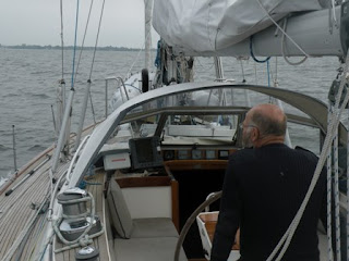
Captain Steve in the Chesapeake

A Sailor Looks at Seventy
Steve has spent his sixties with Litha, and before her, with Beltane. They've kept him in great shape and he's enjoyed them immensely. I guess you could say unfathomably. He loves the navigation, the sailing, the sail tuning, the daily challenges, planning trips, maintaining and customizing each boat, repairing Litha's scars, the self sufficiency of it all. But 5600 miles in four straight months is enough.

To travel hopefully is a better thing than to arrive.

-- R. L. Stevenson

Sunday, May 9, 2010

Cape Fear, Not

Beaufort, NC - We left Charleston May 5 after a day of rain. The weather called for south wind 10-15k so we thought we'd have a good shot at the place they call Cape Fear. And we did, but we motored for all but an hour of the overnighter to Beaufort, NC. As we rounded Cape Fear around 3 a.m., the sea was as calm as a mill pond and we even crossed the Frying Pan shoal off the cape.

Bo-fort, NC

At sunrise on the second day, Steve took this picture of a big thunderpooper that included lightening. He said he thought he'd have to call me up on deck to reef the mainsail, but thankfully, the cloud moved away from us.
Off Cape Fear

As we entered the channel to Beaufort, I saw a couple very large fish, like killer whale types, and one that could've been a large shark. But maybe it was a dolphin. Fishing is big here and fish boats were powering past us in the narrow entrance channel. Lots of pictures fishtales in the bars and restaurants in town.

We've been following the Intracoastal Waterway (ICW) but Litha's mast is a little too tall to pass beneath some of the bridges, so it's out of bounds for us. However, there are lots of boats around that seem to be going that way.

History
Beaufort is a historic town with a nice boardwalk, small folksy marinas, and barrier islands where wild ponies roam. There are concessions for deep-sea fishing and adventure sails. When we were on our way here with the waves just six feet away, I never thought of our trip in those terms.
Beaufort's Ponies
Litha travels the same water, but every port we enter has a different flavor. Now, on the U.S. east coast, we're seeing lots of historical buildings proudly displaying plaques saying "Built in 1817," etc. We are spending several days here waiting for a cold front to pass before rounding Cape Hatteras. Grits are on the menu at the cafe ashore.
Death among the live oaks in Beaufort, NC
A smooth sea will never teach us how best to sail the boat.

Monday, May 3, 2010

Florida to South Carolina

We had a good sail up to Palm Beach and Elizabeth left to return home and life as usual. She'd had more than she expected of sailing -- well, we all had.
This bird was with us for several hours

We were anchored in Lake Worth, the body of water separating the multi-million dollar homes with the their manicured boxwood walls on the east from the unwashed in West Palm Beach, maybe a mile away. Steve and I took a day for R and R and left for points north a day later.

That afternoon, 50 miles later, we entered the strong currents in the ship channel at Ft. Pierce, FL and anchored with several inches to spare near a bascule bridge on the Intracoastal Waterway. After I woke during the night hearing the boat scrape the bottom, I went back to sleep and awoke to hear Steve motoring out of the anchorage at 8 a.m. We'd had enough of shallow anchorages and headed for Charleston, SC. Why not? It's only three days away and the weatherman called for SE winds 10-15 knots and seas 3-4 feet.

We had a good -- if rolly -- sail, wing and wing for downwind, pulling in the headsail at about 4 a.m. each morning. Yes, that's three days and two nights of nonstop sailing with just Steve and I. I'd had enough of the roller coaster ride and very little sleep two days later when we got to Charleston May 2. We made good time with the Gulf Stream giving us a boost of a knot at least. The Gulf Stream is like a river anywhere from 4-50 miles off the east coast. Either it has worn a channel in the sea floor, or it follows a cliff already there. Anyway, it is a force of nature and it was going our way.
Heading into Charleston

My parents drove up from Atlanta and met us for a first ever tour of Litha. And Steve got to tour Charleston for the first time.
Charleston Battery houses

From here it's just around two capes, Fear and Hatteras, to the Chesapeake. Why should I be afraid?

Sunday, May 2, 2010

Storm at Sea

Palm Beach, FL - Elizabeth had never been aboard a sailboat before and our first day out of Key West was
spent motoring into 2-3 foot shallow seas. Not the best way to start, but we made it to Boot Key and had a good
anchorage next to the seven mile bridge. The next day called for too much wind from the wrong direction, so we stayed put and watched fishing
boats come and go, jet skis, played Scrabble, etc.
7 Mile Bridge

The next day we put up the mainsail and headed for Key Largo. The wind had shifted to the south and we had a
brisk sail that eventually died out and we motored into Rock Harbor at Rodriguez Island which the chart showed to
be about 10 feet deep. However, our depth guage read 4.7 when we dropped the hook. There was another, larger
sailboat anchored nearby and others headed in so we felt like they must know something. Anyway, it turned out we were at low tide and I dove down to see two feet of water under the boat and a soft, silty bottom. We were OK. By sunset, eight other cruising boats had anchored.

The next day called for a cold front to pass through and the sky was hazy. We headed out for Miami, ate lunch, it
started sprinking. In the distance we saw thunder and lightning, The Coast Guard issued a warning for severe
weather in the Dry Tortugas area, far away from us. The rain got harder. The water turned to blue from green. We pulled in the headsail. The wind increased and with it the waves. I got out the life jackets and stayed below to stay out of the rain. By this time, we were in a storm and being tossed about. Elizabeth was in the cockpit with Steve who was at the top of his game handling the rough seas and checking the radar for ships and the chartplotter for course and wind gage for direction. Elizabeth signaled that she was OK and I was strangely calm below deck. I didn't want to know the wind speed or see approaching waves. In the face of terror, you handle the matter at hand. The squall stayed with us, seeming to follow us, for an hour or more. This was no fun. The song in my head switched from "Cocomo" to the theme from "Gilligan's Island."
After the storm
I later learned that the wind speed hit and surpassed 50k and the boat speed hit 9and 10k. The sky lightened, the rain stopped, and the sea calmed. Elizabeth is quite a trooper. Litha had no problem.
Miami
We were way off course and so it took several hours to reach Miami. We entered the main ship channel and anchored between Fisher Island and Virginia Key (after getting stuck in the mud), all alone, in between million dollar condos and a park with the Miami city backdrop behind us. Here's to safe harbors.
Fisher Island, FL

Hello and Goodbye

Key West, FL, USA - Gary and Clive had recently learned that British citizens have to have a visa to enter to the US on a private boat and getting one takes at least two weeks. Hmmmmm. Complications. So, all three blue-eyed sailors bid adieu to Litha in Cancun and Chris joined Steve for the journey to Key West.

They left April 19 and thankfully the trip was uneventful. No wind, so pretty boring, but the Florida Strait can be a disaster area, so no complaints either. Meanwhile, I had driven from Colorado to Atlanta, then to Orlando, FL to my friend Elizabeth's house. We drove to Key West and met Steve and Chris on April 21 when they checked in to U.S. customs and immigration in Key West.
key west

We had lunch at Sloppy Joe's (farewell to $1 beers) and shared stories about our trips. Two days later, Chris left and Elizabeth and I boarded Litha to head for Miami.

Steve says the air is much dryer and cooler here in Florida than in the tropics where he's been the last 3 months. But Key West was a zoo of tourists and airplanes, cars, bikes, mopeds, noise. And very expensive. Welcome back to the U.S.A.

Saturday, April 10, 2010

Very Hairy

Belize - (as Steve reported via Sailmail)
They checked in to Belize in Big Creek after Easter, then left Wednesday and went “through the reef.”
Barrier Reef at Ambergris Cay, Belize
The next email said:
We had to go through the reef in a very narrow channel with another little reef just inside the cut. There were big swells pushing us in. The boat tried to surf. Very hairy!! A dive boat was guiding us in. At the bottoms of the swells the depth gage read just less than 2 meters. How was your day?

Heading out through the reef


We are at the port of San Pedro which is on Ambergris. Is. From here we will go (plan to go) nonstop to Is. Mujeres.

It seems that many of the tiny cays are private. They often have houses that are two feet above water and not on pilings. Hurricanes?


Aduana
Checking in to customs and immigration in Central America is a pain. It has cost from around $400 to $12 per country, seemingly at the whim of the person in the office at the time. And to do it right, which not everyone does, you are supposed to check in with every country you enter. Then you need to obtain a zarpe that tells the day you are leaving and the next country you are going to. That's OK if you are flying, but not if you are on a little boat in the ocean at the mercy of the weather.

Friday, March 26, 2010

Escapades of the Blue-Eyed Sailors

Steve and crew sailed from the San Blas Islands to Isla Providencia, a tiny island owned by Columbia in the middle of the Caribbean Sea. They spent a week there among 16 other cruisers and snorkled, went diving, etc. I don't know; I wasn't there. It's all hearsay. Something about riding a scooter around the island, a beach party, and dancing with children. Steve did say that he saw the best coral reefs ever.

Isla Providencia


On March 23, they sailed for Roatan, Honduras, planning to stop at some tiny cays on the way for more diving, lobsters, etc.

From Roatan, they plan to sail to the Cancun, Mexico area. Then, on to Key West, Florida, and the American way of life.


Voyage of the blue-eyed sailors


The map's in your soul and the road's in your mind. (Dan Fogelberg)